Capabilities

The dashboard

Everything AIVA comes together in one dashboard.

The operator does not watch a wall of feeds. Open items land in a queue, open, in progress, closed, and each item is a dossier: enough to review what happened and decide what to do next. Everything else stays out of the way until it is needed.

Beside the queue, a system panel surfaces the conditions that change the picture without being events themselves: blind spots, overdue responses, recurring patterns. Coverage gaps and process debt sit next to the work.

The rest of this page describes the capabilities behind that view. they are represented ineach dossier and what keeps the queue honest.
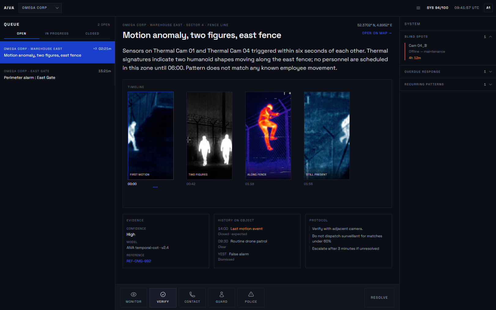
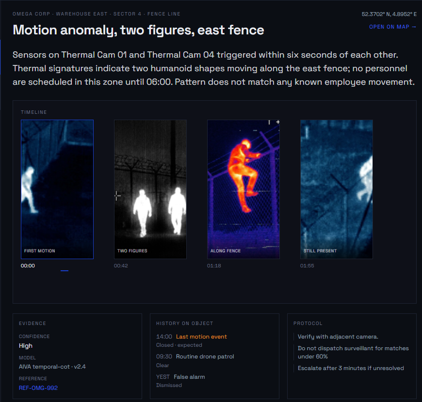
AIVA dashboard with event queue, open dossier, and system status panel

The Situation Report

The SITREP is the operator's live interaction layer.

It a high-level overview of the situation or events, what needs attention right now, with everything else one click deeper.

The overview surfaces the things that require a decision, and the operator clicks through from there into the detail behind each one: the observation, its status, and the footage it came from. A commander scanning the SITREP sees what changed and what needs a response, without wading through what is normal.

Because AIVA runs many detection processes at once across different feeds and points in the scene, a single situation can be reflected in more than one place, the same event picked up from more than one angle. These observations are linked, so the overview shows one coherent picture rather than the same thing reported several times.

Incident view with SITREP access, footage, and briefing panel beside the feed

Source-linked data

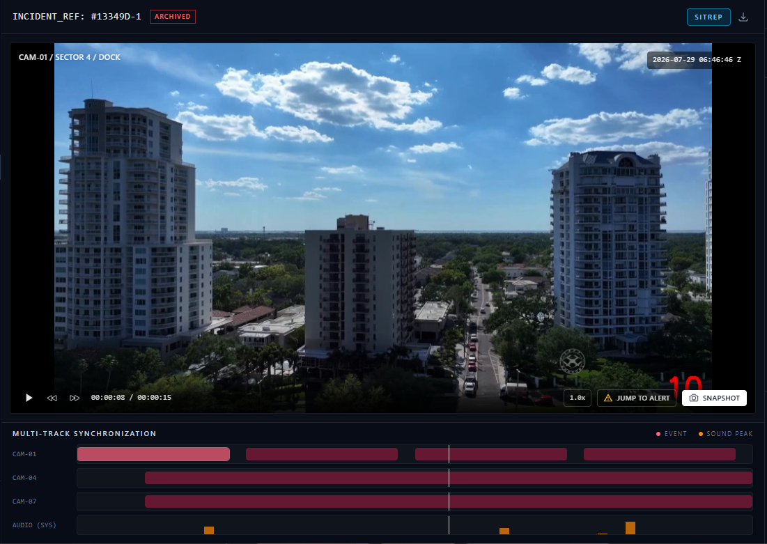
A SITREP links back to the footage it came from.

An observation is not a claim floating on its own, the operator can move from a line in the report to the imagery that produced it in one step, and the same link holds when the incident is reviewed later. This is how the click-through in the SITREP works: the detail behind an observation is the footage itself.

The practical effect is that a decision taken on the basis of the SITREP can be reconstructed and explained after the fact, against the actual imagery rather than against a summary of it.

Incident footage with jump-to-alert controls and multi-track event timeline

Confidence and uncertainty

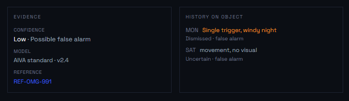
Each observation carries a confidence indication, and the system states when it is not certain.

Where the imagery does not support a firm conclusion, the SITREP says so "exact count cannot be confirmed from available imagery" is a valid and expected output, not a failure. The report distinguishes what was observed from what is inferred.

This is a deliberate boundary. AIVA generates observations and recommendations; the operator decides. The system is built to surface its own uncertaint, because a report that overclaims is worse than one that flags its own gaps.

Incident footage false postive and analysis

Simultaneous multi-source ingest

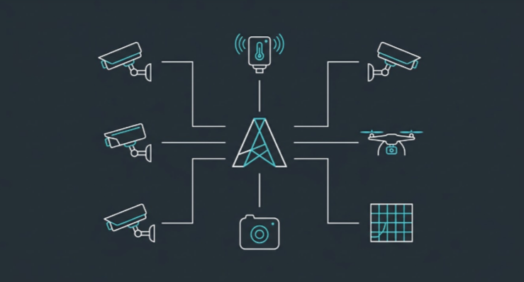
AIVA reads multiple feed at once, drone, fixed camera, bodycam, and analysing more sources does not slow the others down.

This is the main reason to use AIVA. The more cameras you have, the harder it becomes to keep an overview: more feeds than anyone can watch, and events on one feed that are related to events on another without anyone connecting them. There is a limit to how many screens a control room can watch, and staffing does not scale with camera count.

AIVA reads all of the feeds continuously and works out how what it sees on one relates to what it sees on another, so the operator gets one combined picture instead of a bank of monitors to divide attention across. Adding a camera adds coverage, not workload.

Multi-track synchronization across CAM-01, CAM-04, CAM-07 and system audio

Scene understanding

AIVA interprets a scene, rather than only detecting objects in it.

The difference is concrete. Object detection returns "15 people, 8 vehicles." Scene understanding returns "a crowd is gathering at the northern exit, traffic is diverting eastward, no evacuation movement visible." The second is what a trained observer would report, it carries meaning, not just counts. AIVA uses vision-language models to read context: a smoke plume that may indicate fire, personnel near a perimeter, a change in how a situation is developing.

multiple cameras and feeds showing a scene

Map and digital twin

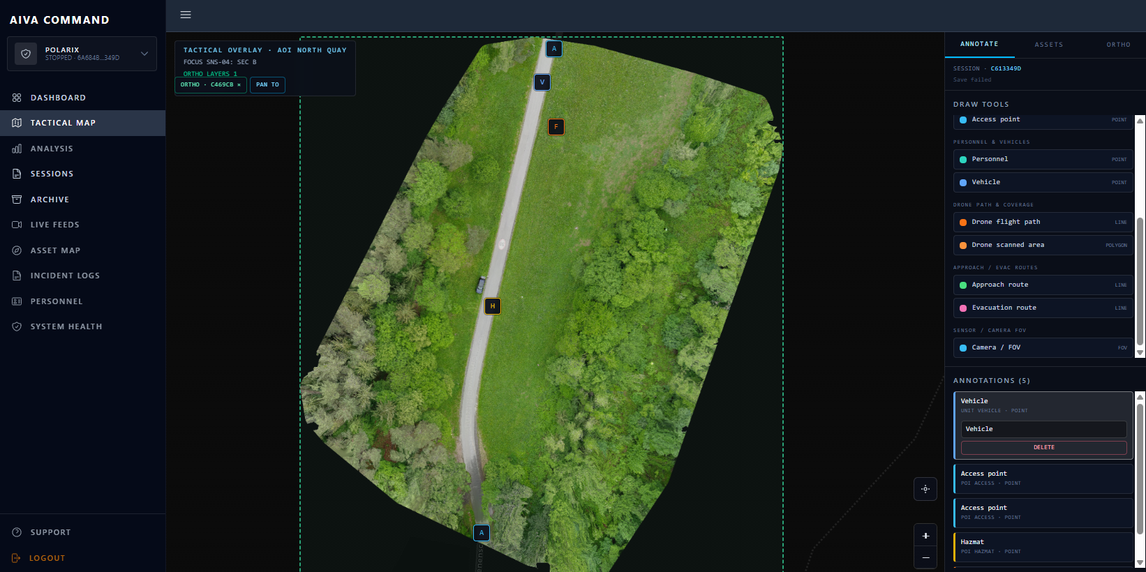
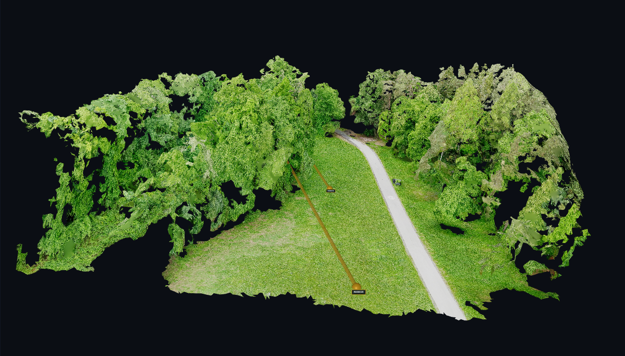
AIVA orthorectifies drone footage into a 2d and 3d map, rendered inside the system.

The flyover that builds the map can be flown two ways. Either as a dedicated pass beforehand, the drone covers the area, and AIVA produces the map before the operation runs on it, or continuously, from the live feed while interpretation is already happening, so the map is built and updated during the operation rather than only in advance.

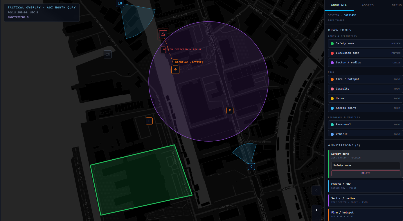
The resulting map is visualised in AIVA itself; the operator works with it in the dashboard, not in a separate GIS tool. Annotations land on the map from two sources: the recognition system places observations at their location automatically, and the pilot can add or adjust markers by hand. Both appear on the same map.

Because each flyover is retained, the map has a time dimension. Multiple passes are held as separate points in time, and the operator can move between them, an earlier flyover against a later one. AIVA looks at that difference automatically: what changed between two passes, what is there now that was not before. This is the same long-temporal-context focus applied to the map, understanding a site not as a single snapshot but as how it developed across passes.

AIVA tactical map with orthorectified imagery and annotation tools
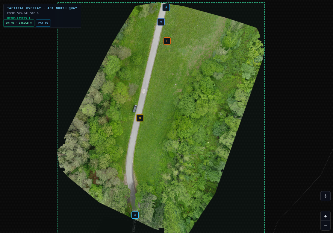
Orthorectified map with draw tools and placed access, vehicle, and hazard markers

Interactive map

Draw perimeters on the orthorectified map, AIVA suggests markers from what it detects.

The map is interactive, not a static backdrop. Operators draw perimeters and zones directly on the orthorectified view of the area, so the site layout and the operational picture live in the same place.

As detections come in, AIVA proposes markers on that map, vehicles, obstructions, and other observations placed where they were seen. Suggestions sit live on the orthorectified imagery; the operator accepts, adjusts, or adds their own.

What is drawn by hand and what the system suggests share one layer. The map stays current with the scene, without switching to a separate GIS tool to mark what matters.

Interactive orthorectified map with annotation draw tools and placed markers
Orthorectified map with vehicle, obstruction, and hazard markers

Privacy boundaries

AIVA is built to operate without identifying individuals.

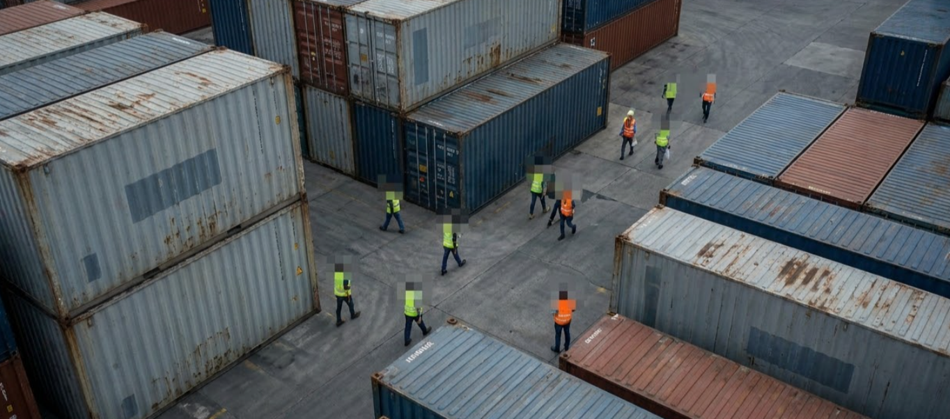
Anonymisation is applied through segmentation, masking people in the imagery, and the system does not perform biometric identification. This is a boundary in the design, not a setting that can be switched off for convenience. The processing produces situational understanding (how many, where, doing what) without producing identity.

Image and operational data remain the property of the end user, and are processed only within the agreed scope of a deployment.

industrial site with anonymised people in the imagery

Hosting

AIVA runs where the data needs to stay.

  • European cloud — Hosted within the EU, for organisations without their own infrastructure requirement.
  • Private cloud — A dedicated, isolated environment.
  • On-premise — Deployed inside your own network, for environments with strict data, latency, or sovereignty requirements, including settings that align with controlled-network standards

Because AIVA can run entirely on-premise, inference on camera feeds can happen inside the operator's own network, without footage leaving it. In Secure Data Mode, all outgoing traffic is blocked by default except what is explicitly approved.

Interested in what AIVA can mean for your sector?

Tell us who you are and how you want to be involved. We will be in touch.